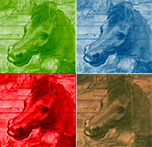
The technique consists in acquiring images in the visible spectrum and in the thermal infrared by drone and processing the data with diverse softwares, to obtain multispectral orthophotos, products of spectral indices, digital terrain models, thermal maps.
Fields of application
-
Cultural heritage
archaeological object and site, architecture
Materials
TOOLS

The multi sensor system carried is composed of three cameras: i) multispectral camera with 9 sensors that, using band-pass filters, acquire at 8 bands of the electromagnetic spectrum (plus RGB), comparable to the VIS-NIR bands acquired by the Worldview2 satellite; ii) radiometric thermocamera with the following characteristics: Frequency 30Hz, 640 640 x 512 resolution, Optic...
